As already mentioned in previous posts, in Kazakhstan I drove the “Russian branch” of the Great Silk Road, which passed through the places where Troitsk, Kustanay, Arkalyk, Zhezkazgan, Alma-Ata now stand. And the ancient route entered the territory of Kazakhstan where the town of Zharkent (41 thousand inhabitants) now stands, 350 kilometers from Almaty and only 100 kilometers from Gulja in China. Actually, it was refugees from Gulja who founded it in 1881, and initially it was the capital of the Taranchi - Uyghurs and Dungans, Muslim farmers of East Turkestan - who moved to Russia. Nowadays Zharkent is Kazakhstan’s “gate to the east”, the main road entrance to China, and its central street is called Zhibek Zholy, that is, the Silk Road. The main local attraction is captured in the introductory frame.
...In fact, the history of Zharkent (Dzharkent) is a little more complicated than it seems. I already told it in a post about, but I have to repeat it here. Until the annexation of Semirechye to Russia, there was no city here - as unnecessary, this role was perfectly fulfilled by Kuldzha. But in 1864, the border of two empires passed here, and the place was not empty for long: in the same year, Xinjiang was engulfed by the Uighur-Dungan uprising against China, the rebels quickly defeated the government troops that were helpless at that time, and by 1867 several quasi-states arose in East Turkestan - primarily the Ili Sultanate with its capital in Ghulja and Yettishar (Semigradye) with its capital in Kashgar. The second one was reliably separated from Russia by the Tien Shan, but something had to be done with Gulja: the Uighurs and Dungans first slaughtered each other, and then began to prepare to go to war against Russia. Out of harm's way, in 1871 the empire sent troops to Ili under the leadership of Semirechensk governor Gerasim Kolpakovsky. Over the following years, the Chinese did restore order: in 1877, Zuo Zongtang conquered Yettishar, and in 1881, Gulja was returned to China. However, tens of thousands of Taranchi decided that life was better under Russia, and left for Semirechye. Dzharkent, founded for them, immediately became the 5th largest city within the current borders of Kazakhstan - after Uralsk, Semipalatinsk, Verny and Petropavlovsk (16 thousand people at the beginning of the twentieth century), but then gradually became an ordinary regional center, and in 1941-91 it was called Panfilov.
In Semirechye you quickly get used to the fact that the landscapes replace each other like a kaleidoscope - but still the luxurious deciduous forests, closing in galleries over the highway, into which you suddenly find yourself 20 kilometers before Zharkent, become a complete surprise. It is no coincidence that the Uyghurs were the first farmers in the Great Steppe, and their old self-name “taranchi” means farmers. At the entrance to Zharkent there is the rocky bed of the Usek River and the icy peaks of the Dzhungar Alatau looming in the distance - a huge and inaccessible highland, separated from the Tien Shan by the Ili Valley and forming the borders of Kazakhstan with China. These mountains are more than 40 kilometers away, and their average height is 3500-4000 meters:
All these shots were taken in the morning, already on the way to Altyn-Emel. And we arrived in Zharkent in the evening, on a private boat from Chundzhi, and in response to our wish to take us to the hotel, he dropped us off at the Zhibek-Zholy hotel at the entrance to the city. Well, here my acquaintance with Kazakhstani bedbugs reached its climax! The hotel occupied the second floor of a three-story building, above the restaurant, and had a layout already familiar to me from Karkaralinsk - several very cheap rooms without amenities, one “suite” and a maid’s room. We settled in a two-room “suite” for 4,500 tenge (about 900 rubles) for two, and the maid immediately warned us:
-Only we don’t have a lock, the previous guests broke it. It’s okay, I’ll guard you - however, both rooms were locked from the inside.
The bathroom in the room was designed according to the scheme “a rear-view mirror is placed at the back for the convenience of the driver”: the sink and shower were raised to a considerable height, which the leaking taps made very slippery. Hot water, of course, had to wait half an hour with the tap open, but it lasted about 10 minutes. But the apotheosis came when Darkia looked into the shower stall, and at that time I was paying the maid:
-Do you want to see what creature is sitting there?
This was sitting in the shower, and it was about half a finger in size (as I was told in the comments, this is a flycatcher, or a house centipede - a useful animal, but poisonous, about the same as a bee):
The maid washed off the “creature” and calmly explained:
“Yes, there’s a hole in our ceiling, they’re falling out of it,” in such a tone, as if it’s completely normal that in a hotel room there’s a hole in the ceiling from which centipedes are falling. As a result, Darkiya demanded a discount, and I demanded that the hole be plugged. In general, against the backdrop of all of the above, the cold, dirty floor and smelly plumbing were no longer bothersome. Such is the colonial romance in the style of Kipling...
In the morning we were very glad to leave this establishment. Dawn Zharkent greeted us with the grandeur of the Mountains:
And in the house next to the hotel, I filmed a scene that I had come across more than once in Kazakhstan before. The pipes of potbelly stoves sticking out of the five-story building are an eerie reminder of the 1990s, when heating and water became a luxury:
Although the city as a whole is quite large and lively, it feels like not 40 thousand live here, but at least twice as many. Silk Road Street runs right through it, to the bus station at the exit towards China, and divides the old center in half - judging by the architecture, there was a Russian district to the north of it, and a Taranchin district to the south. Stop opposite our hotel:
Clearly pre-revolutionary houses with a very characteristic “oriental” appearance come close to the street:
One of the houses had this rarity lying around - as they suggested to me in the comments, a Moskvich-401 (produced in 1946-54) or a captured Opel, that is, the car was in any case very much over half a century old:
Quite quickly, a new center begins, representing the “facade” of a huge bazaar to the south of the highway. There are many hotels in Zharkent, due to the fact that the city is located on an international road, and I think we chose the worst of them.
Monument to the imps:
In general, Zharkent occupies a fairly large area, approximately 6x5 kilometers, and what is especially impressive is that it all consists of identical rectangular blocks - an effect of its artificial foundation in 1881. The Silk Road cuts it almost in the middle, and we walked less than half of the city, turning in the area of the local House of Culture:
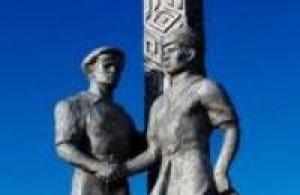
The monument in front of the Palace of Culture is not to war heroes (as I thought at first), but to the “Decembrists,” that is, participants in Zheltoksan, the riots in Almaty in December 1986. These two, natives of the Panfilovsky district, were among those who were sentenced to prison terms and died either during the investigation (it’s easy to guess how), or already behind bars:
Most of Zharkent, except for the main street, looks something like this, and if you don’t know what to look for, it gets boring here very quickly:
In some places, however, you can come across county houses, and since Dzharkent, unlike Verny, was almost not damaged by the earthquake in 1887, their architecture is much more Central Russian than in Alma-Ata. This one, for example, stands right on the Silk Road:
And this one adjoins it at the back, and is occupied by the regional museum:
Although even such houses are rare here - mostly Old Zharkent is represented by something like this:
And its main feature is the details. For example, gates and verandas of unusual design:
Quite understandable platbands:
And absolutely stunning pediments - I have not seen these anywhere else, and I suspect this is the most Taranchin wooden architecture:
A couple more samples in the southern part of the city are also apparently Taranchin cases:
We found the most impressive house in the northern part of the city, next to the Elias Church, in the characteristic “Vernensk style”. What it was and why it stood out so much - I don’t know, but most likely either the administration (in the suddenly emerging settlement city she had a lot of work!), or some kind of school:
The Elias Church itself was built in 1892, and is a type of Russian church quite typical for Semirechye with a stone bottom and a wooden top:
Ancient churches in small towns in Kazakhstan are a huge rarity, and, for example, the priest we met in Priozersk knew about this church:
But these are all details.
In fact, Zharkent is a city of one attraction, and this attraction is located just south of the Silk Road, behind the bazaar. This is the Dungan mosque, one of two in the former USSR, and at the same time a larger and richer one.
The Dungans, or Hui, are the same Chinese, but they differ from the Han in that they profess Islam. About 10 million Hui live in China, they even have their own autonomous region. In 1881, the Dungans fled to Russia along with the Uighurs, and initially both lived in Semirechye, but in the twentieth century the Dungans moved further west, and now their enclave is the Chui Valley, approximately 50 thousand Dungans live in the Dzhambul region of Kazakhstan and Chui region of Kyrgyzstan. There are much fewer of them in Kazakhstan than the Uighurs, and in modern times they are much less visible - but they have enriched the architecture much more. Because the Muslim Chinese even built mosques in their own Chinese tradition.
More precisely, in Zharkent everything is even more complicated. The mosque was built in 1892 at the expense of the Uyghur merchant Vali-Akhun Yuldashev, who was the true owner and partly the builder of the city, by the Dungan architect Khon Pik, and it combines elements of Chinese and Turkestan traditions. The mosque is surrounded by a courtyard measuring 28x52 meters, and the entrance is through a portal that looks quite Central Asian:
If only it weren’t for the “floating roof” hanging over it:
How can one not recall the great Battle of Talas in 751, in which the Arabs defeated the Chinese, but they themselves decided that it was not worth going further to the east - after, however, Islam seeped into China, and the achievements of Chinese engineering, such as writing paper, into Arabia .
On the other hand, it is clearly visible that the wooden “pagoda” (that is, in fact, a minaret) is simply placed above the stone porch:
We never got inside the mosque - it was only open for services, which were not held that morning. We walked along the fence, which here is completely in European style:
Until you look through the gate:
Fortunately, 2/3 of the mosque courtyard is covered by a fence like this, through which everything is clearly visible:
And the mosque itself, standing in the depths of the courtyard, turns out to be very small and squat. At one time there was also a madrasah, and apparently there was a whole “town” in the courtyard:
Porch of the mosque:
The wooden parts are made from Tien Shan spruce, of course, “without a single nail”:
If not for the second minaret, the mosque building would have been symmetrical. This minaret stands above the mihrab, and is much more luxurious than the one above the gate. Perhaps, of all the elements of the mosque, it impressed me the most:
This is an incredible building:
By that time, we were bored to death with buses and minibuses, and I suggested leaving Zharkent by hitchhiking. Our next goal was the Altyn-Emel National Park, where we decided to break through at random, since Darkia persuaded me to get there at any cost, she was already on the way, and I had not prepared in advance. The village of Basshi, the “gate” of Altyn-Emel, is about 80 kilometers away. We stopped the first car within the city, and a very friendly Kazakh driver took us to a fork near the village of Koktal - in one direction Chundzha, in the other - our goal. Along the way, he said that he was working on the construction of the railway, which was closed with the Chinese a few months ago. In principle, there is a railway to China from Kazakhstan - but much further north, through the disastrous Dzhungar Gate gorge in a sparsely populated area. I immediately remembered that on the way from Chundzhi we crossed the railway, and I was also surprised where it came from. But the railway corridor from the Caspian Sea to China is a local construction project of the century, which I was already told about in Zhezkazgan. Regular traffic to China via Zharkent is promised to open in three years - a note to railway researchers.
Zharkent became for me the farthest point of my journey through the Great Steppe, so then the journey home begins. The next part is about the landscapes and villages of such different Semirechye on the way to Altyn-Emel.
P.S.
And by the way, they are seriously afraid of the “Chinese threat” in Kazakhstan. And logically, Kazakhstan is the most likely direction of territorial expansion of the Celestial Empire. There is fertile land, water and minerals, but no nuclear bombs or ballistic missiles. So while the Chinese are not interested in Semirechye, Siberia can sleep peacefully.
My other posts about Kazakhstan -


Sights of Zharkent.
"...in order to write history,
need historical deletion,
we need perspective, we need precise names,
dates, a number of recorded and verified
testimony"
Peter Krasnov.
Excursions around Zharkent.
Zharkent (Kazakhs. Zharkent is a city in Kazakhstan, the center of the Panfilov district of the Almaty region. It is located 200 kilometers east of the Saryozek railway station (which is on the Semipalatinsk - Almaty line) on the Saryozek - Khorgos highway, 29 kilometers from the Chinese border.
Zharkent - “City on a cliff” (Kazakh). Population – 33,000 people. The city has a garment factory, a construction products factory, and a meat processing plant. The Almaty – Korgas (Khorgos) – Urumqi (XUAR, China) highway passes through Zharkent. The most significant attraction is the Zharkent mosque, built in 1895 from Tien Shan spruce by the Chinese architect Hon-Pik. The total area is 26 x 54 square meters. The minaret is surrounded by 52 columns, the interior is decorated with Arabic script using national ornaments.
Old names: before 1942 – Dzharkent, 1942 - 1991 – Panfilov, since 1991 - Zharkent. The city of Zharkent was founded in 1881, when, as a result of the Treaty of St. Petersburg, part of the lands of the western part of the Ili Valley remained with the Russian Empire.
On the site of old Uyghur villages, General Kuropatkin founded a new city. In 1882, it was part of the Semirechensk region. Zharkent (from 1942 to 1991 - the city of Panfilov) received city status in 1882 in connection with the determination of the southwestern border of the Russian Empire and the organization of a district center here.
The current name “Zharkent” was adopted in 1991. The coat of arms of Dzharkent was approved on March 19, 1908, along with other coats of arms of the Semirechensk region. "In the golden shield on the top of the mountain is a deer of natural color. In the free part is the coat of arms of the Semirechensk region."
The city is located in a convenient geographical location, on the border with China, so there are ample opportunities for further improvement of trade relations and development of tourism.
The mineral springs available in the area, according to scientists, are superior in quality to the mineral water sold in the retail chain, even Borjomi. Modern Zharkent, the center of the Panfilov district of the Almaty region, is located in the south-eastern part of the Republic of Kazakhstan, on the flat part of the Dzungarian Alatau, a highway of republican significance passes through it, which connects the city with the region, the center of Taldykorgan and the southern capital of Almaty.
Distance from Taldykorgan - 290 km, from Almaty - 345 km and the nearest railway station Sary-Ozek - 170 km, from the new railway station of Kunduzdy, distance 20 km, from Altynkol station, distance 30 km.
The total area of the urban district is 20,607 hectares. Agricultural land - 18080 hectares, including: irrigated arable land 4487 hectares, pasture land 13197 hectares, hayfields 422 hectares.
Citizens' private plots amount to 906 hectares. The land is suitable for growing grains, vegetables, potatoes, fruits, grapes, melons and oilseeds.
Zharkent urban district is an area of irrigated agriculture and is provided with moisture throughout the calendar year. Favorable climatic and natural conditions, its landscape allow the city's population to engage in all types of agricultural production, viticulture and fruit growing.
The territory of the city of Zharkent is 47.25 sq. km. The population of the city of Zharkent is 43,119, national composition: Kazakhs - 33%, Russians - 0.7%, Uyghurs - 52%, other nationalities - 0.8%.
There are 6,115 pensioners living in the city. The total number of households is about 10,000. In 2014, 1,252 children were born. In the city there is a museum of the history of the Zharkent police, from the materials of which you can learn about the famous operation to eliminate Ataman Dutov and his entourage at the beginning of the last century. Zharkent is home to many more high-profile and important names for the history of Semirechye.
One of the attractions in Zharkent is an abandoned pre-revolutionary fort, built at the end of the 19th century by a Cossack garrison. At the prison entrance there is a door made of boards seven to eight centimeters thick, sunk into the ground, with a small window.
One look at this door is enough to understand that this is a prison gate. Behind the gates a gloomy picture appears: a two-story wooden building, blackened by time, with one-story wings extending to the sides, with blackened gaps of unglazed windows.
In Soviet times, the prison building housed a dormitory for a pedagogical school, and then the building was abandoned. After privatization, they wanted to make a hotel here, but apparently there were no people willing to spend a night or two in prison, and the idea was abandoned.
So the building serves as a playground for the surrounding children and an object of infrequent attention from tourists. In modern Zharkent, the proximity to China is felt in everything: in the architecture of the cottages of local entrepreneurs, in the style of restaurants and cafes and, of course, in the cuisine.
The local history museum at boarding school No. 6 was founded half a century ago from an ordinary exhibition stand in the school corridor, and the exact opening date is April 22, 1970.
This event was timed to coincide with the centenary of the great proletarian leader Vladimir Lenin. The curator of the museum was Daniil Vazhnin. An ordinary school teacher taught geography to children and led a local history club.
It survived both the heyday of the museum, when the exhibition was located in a separate school room, and the museum itself received the title of the best school museum in the republic (this was in 1978), and perestroika, and the complete collapse of the Soviet system (and with it the museum).
Daniil Vazhnin did not live to see the revival of the main cultural value of Zharkent. Several years ago, or rather in 2008, thanks to the efforts of the school director Aitzhamal Kombekov, a friendly team of teachers and students, the destroyed wealth was restored.
True, the museum was restored only in one room of the rural school. The museum room is literally filled to the very ceiling with displays, family and regional heirlooms.
People bring it, give it as a gift, tell it to their children and grandchildren, and they write in their notebooks the history of their family, their street - everything that makes up that small homeland.
It would seem that there is nothing to surprise a sophisticated urban viewer in a rural museum. But you walk along the walls, look into the faces, read the simple words of certificates of honor and letters, and at some point you begin to understand that it is in such a compressed space-time that the history of the Semirechensk region, and the republic as a whole, is better and more clearly imprinted.
Here in the corner stands a solid chest, on it is an arithmometer, sophisticated for a modern person - those who survived the era of calculators certainly “can’t understand without half a liter.” Nearby is a Soviet-era typewriter “Yatran” and a battered teapot, and personal belongings of the internationalist warrior Erbolsyn Konchibaev, who died on Afghan soil.
Here is a photo of young guys before being sent to the front. It’s 1941, they are taking pictures, few of them will return to their native places... Eight Zharkent residents became Heroes of the Soviet Union in the bloodiest war of the last century.
The Semirechensk frogtooth lives in a jar. It is difficult to imagine that all these documents, personal belongings, photographs were collected thanks to the efforts of a simple school teacher.
By the way, more than one generation has grown up with these skillfully designed display cases, and every child learns to comprehend culture in their own museum. That’s why it’s no less offensive to lose these small exhibitions than, God forbid, the republican museum.
Another unique chest can be seen in the famous architectural and artistic complex “Zharkent Mosque”. According to legend, he came to these places during the First World War.
You can believe this because the inside of the chest is covered with newspapers printed in Tsarist Russia. I believed, together with the residents of Zharkent, in the great, if not the great, history of these places.
Why not? And there is no need to invent anything, because the story is really interesting. Entry into border Zharkent is still strictly with passes. Therefore, many Almaty residents do not even know about the Zharkent mosque.
The impressions made by a mosque built in the style of a Chinese pagoda remain, without exaggeration, for many years... It turns out that three similar buildings were built: a temple in Shanghai, a mosque in Ghulja and a mosque in Zharkent.
The temple in Shanghai was destroyed when China began to build socialism, the mosque in Ghulja burned down. “During its 116-year history, the Zharkent mosque has also experienced a lot, but has survived!” – with these words the current rector of the mosque, Shariphan-kazhy, begins his tour.
In 1910, the mosque survived a severe earthquake. Many buildings in the city turned into ruins, but she survived, although she received some damage. And in 1965, a hurricane wind swept through Zharkent, but the structure withstood this natural disaster. Over the years, the building was used for warehouses and a granary, people lived in it, and every year it fell into more and more disrepair.
Zharkent residents could have completely lost this ancient monument if the first secretary of the Central Committee of the Communist Party of the Republic Dinmukhamed Kunaev had not visited here in the late 70s. After this visit, restoration work began at the mosque, and the monument was taken under state protection.
And in the courtyard of the museum complex there grows a large branched tree with the Arabic name “Seyda”. Shariphan-kazhy claims that everyone who touches him can make a wish that will definitely come true...
Perhaps this fascinating past is what attracts contemporary artists to Zharkent: what if a rural muse, raised on fresh milk, suddenly visits me? The only thing that seemed strange in the Zharkent art gallery was the absence of works by artists dedicated to city life.
Here there are mostly paintings that are quite understandable even to a one-year-old child: the artists paint romantic landscapes surrounding their beloved Zharkent. Mostly local artists exhibit.
The exhibition changes frequently – once every three months. There is also its own art studio, where not only young Zharkent residents, but also adults enjoy studying. They learn to draw and study the history of fine art.
Ask: Do they need it? Imagine yes! It’s rare that non-specialists know who wrote “Black Square” and what it even is. But in Zharkent they know! And, by the way, the children who visit this art studio not only participate in traveling art festivals in Almaty and Astana for several years in a row, but also help the head of the art studio, Sholpan Zamanbekova, piece by piece to collect the artistic history of these places, continuing this small feat - a museum of their sat down. By the way, the art gallery is named after Ablaykhan Kasteev, who was born here in the village of Chezhin.
Finally, let’s walk through the gallery again and smile at the works of Ablaikhan Kasteev “Chezhin” and “On the Current”. These paintings by the great artist can only be seen here in Zharkent.
Many of the Zharkent residents with whom I was able to talk happily repeated that it is fashionable to go to a museum or gallery, as well as to know the history of their native places. A striking example of these words is Kurmanzhan Akhmetkaliev.
On his initiative, a stunning sculpture park was opened on the territory of the Koktal-arasan children's sanatorium. Characters from your favorite fairy tales greet everyone who comes here. Many of them were made by Kurmanzhan’s hands.
Would you think he is a professional sculptor? No, he has a medical education, he is a deputy of the local maslikhat, and in his free time he is busy with creativity. In general, just a passionate person...
We continue to tell our readers about the small cities of Kazakhstan and this time we set off along the route Almaty - Zharkent. What attracted us to this small border town? What is so special about it that other cities don’t have? About this in our report today. Well, let's go?

City Zharkent is located in the Almaty region and is the regional center of the Panfilov district. Our route runs along the A2 highway, Almaty - Khorgos, popularly called “Kuldzhinka”.
It’s a stone’s throw from Zharkent to the Chinese border—only twenty-nine kilometers. And we covered the distance of three hundred and twenty-six kilometers from the Southern capital by car in five hours.

The nature in these parts is unique. All along the way, a truly picturesque picture appears before our eyes. Beyond the steppe, covered with low-growing grass, the snow-capped peaks of the Trans-Ili Alatau rise, and thickets of turanga - variegated poplar - grow along the rivers.
Another miracle of nature that you will meet on the way to Zharkent and which we can rightfully be proud of is an ash grove in the lower reaches of the Charyn River. This grove is unique in that the Sogdian ash growing here grew even when now long-extinct animals roamed Semirechye. The second such planting of Sogdian ash exists only in North America.

Along the way, we couldn’t help but stop to take a photo of this little steppe inhabitant. The curious animal was so interested in us that it happily posed in front of the camera.

So, we are in Zharkent.
The population of this border town is 41,120 people. 53% of the inhabitants are Uyghurs, 38% are Kazakhs, and the remaining 9% are Russians and representatives of other nationalities.
The city is proud of its famous natives, including the painter and watercolorist, People's Artist of the Kazakh SSR, the founder of Kazakh fine art Abilkhan Kasteev and famous Kazakh pop singer Makpal Isabekova, as well as members of the group “Dervishes” Dilmurat Bakharov And Khanzat Vilyamov.
Five veterans of the Great Patriotic War live in Zharkent.
This historic town is also attractive for film industry workers. It was here that the films “The End of the Ataman” and “Trans-Siberian Express” were filmed.

The history of Zharkent goes back centuries. Once upon a time, the city was one of the fortified points on the Great Silk Road, as evidenced by archaeological finds. Historians claim that it was in these parts that the battles between the Dzungars and the Kazakhs took place.
In 1881, General Kuropatkin was instructed to find a place to create a Russian district center in this region. This is how Dzharkent appeared on the site of the old Uyghur villages, which acquired the status of a city in 1892. The city was inhabited mainly by Cossacks, who guarded the Russian eastern borders from their neighbor from the Middle Kingdom, and Uyghurs - the first “shuttles”.

Great importance was paid to the development of this city. One of the first to be built here was a brewery, as well as a tobacco factory. This area had all the conditions for growing excellent tobacco. Small private shops were stocked with Chinese and Russian goods, and local artisans supplied both travelers and townspeople with everything they needed.
From 1942 to 1991 the city was called Panfilov, and in 1991 it was again renamed Zharkent.

Speaking about the history of this city, one cannot help but talk about the buildings that its founders left us.
A unique architectural monument of the 19th century, as well as the pride of this town, is the Zharkent Mosque. Construction of the mosque began in 1887 and was completed in 1892 according to the design of the Chinese architect Hon Pika. The role of the main sponsor and organizer of the construction of the mosque was taken on by the merchant of the first guild Vali Akhun Yuldashev.

To implement the grandiose project, more than a hundred of the best craftsmen from all over the region were gathered. In order to ensure complete unity of action between multilingual builders during construction, the artel acquired translators who spoke Chinese and several Turkic languages.

We enter the huge hall of the mosque, filled with squeaking and chattering. Who is this? Birds?
And here, under the ceiling in the twilight, we see a whole colony of bats. Looking around, we realize that these gray winged creatures are everywhere here. Here they live, reproduce, winter, and no one drives them out or exterminates them.
It is surprising that thanks to bats this wooden structure retains its original appearance. Do you know why? Yes, because the little guardians of the Zharkent mosque protect their habitat from various insects and bark beetle larvae.

During its one hundred and twenty-four year history, the Zharkent mosque has experienced a lot, but still survived. During a strong earthquake in 1910, both decorative towers collapsed. We had to close the stairwells leading to the roof.
With the advent of Soviet power, this building was used for various needs. There were warehouses, a granary, and a barracks for border guards, and in the post-war period - a cinema and a teahouse. So every year the mosque fell into decay more and more.

In 1949, for the first time, an in-depth study of the mosque was carried out, as a result of which this historical building was taken under state protection.
During the restoration work of 1975-1978, a decision was made to create the state architectural and artistic complex “Zharkent Mosque”. And now thousands of tourists admire this architectural monument every year.

The main building material for the mosque was Tan Shan spruce logs, which were brought here by swimming along the Ili River. It is noteworthy that not a single nail was used during construction.
There are one hundred and ten wooden columns inside the structure, and sixty outside.

The interior and exterior decoration is dominated by plant motifs, but there are also images of birds, fish, real and fantastic animals, and Arabic script. In some places, paintings from ancient times have been preserved, which were not touched by the restorer’s brush. The bright colors did not fade or crack at all.

Rumor has it that the Chinese architect had previously erected a beautiful structure in his homeland. But jealous admirers of his talent began to fear that the master might create something similar elsewhere. And in order to prevent this from happening, they decided to take the architect’s life. After the news about the impending “reward,” Hong Pik’s only desire was to get away as far as possible. This is how the Chinese architect appeared before the eyes of Vali Akhun Yuldashev, who was preoccupied with finding an architect. Later, upon returning to Beijing, he was executed.

In the courtyard of the museum complex there is a huge branched elm tree. He is the same age as the city and a witness to all events. There is a belief that if you touch a tree and make a wish, it will certainly come true.

And one more historical heritage of Zharkent, which we could not help but mention, is the Orthodox Church of the Prophet Elijah, built by the Cossacks in the style of the Vernensky Cathedral.

According to archival data, the question of building a temple in the city was raised by the Cossacks on August 12, 1882, with the assistance of a clergyman Pavel Beloyarova, who headed the Orthodox Church in China, in the city of Ghulja. Beloyarov had 4,000 rubles in his account, and the merchant donated another 5,000 rubles Somov, but these funds were not enough, so the construction of the temple was delayed. And only ten years later, in 1892, Dzharkent finally had its own Russian Orthodox Church.

In 2017, the Prophet Elias Church will turn one hundred and twenty-five years old. Now, in connection with the upcoming event, external and internal restoration work is being carried out.

The structure is entirely made of Tien Shan spruce. During the Soviet hard times, the church was closed and was not used for its intended purpose. There was a granary here and a teacher training school gym, where physical education classes were taught and entertainment events were held.

Only in 1991 the church was returned to believers. On May 17, 1992, exactly one hundred years after the construction of the temple, a priest was appointed rector Pavel Ivanov, now abbot Vianor, who serves here to this day.

This temple is unique in that it contains Orthodox shrines - the relics of priest Vasily Kolmykov, priest of Zharkent, and fourteen Cossacks who were brutally killed by the Bolsheviks. The Bolsheviks demanded that the priest renounce his faith, and for this he accepted martyrdom. In 2000, Vasily Kolmykov was canonized.

The temple also contains particles of the relics of St. Innocent, Bishop of Irkutsk, the venerable martyrs of Almaty Seraphim and Theognostus, and the priestly confessor Nicholas of Mogilev. And hundreds of people come to the miraculous ancient image of the Mother of God, called “Joy of All Who Sorrow,” to ask for healing and deliverance from infertility.

Well, we will return to modern Zharkent.
Zharkent is one of the few small towns in which the question of where to walk or relax is not an urgent one. The city has a modern House of Culture, nightclubs, and discos. There are also two recreational parks with attractions, popularly called “children’s” and “adults”.
There are a large number of cafes for every budget, famous for their Uyghur cuisine. And those who are passing through Zharkent buy Chinese beer in stores. But enterprising sellers in stores outside the city, seeing how much demand this amber drink is in, “charge up” prices to 350 tenge per bottle. So don’t rush to overpay, because in villages located closer to the border, the same beer will cost 250 tenge.

As for the social sphere: the city has a children's clinic, an inpatient hospital, a maternity hospital, and there are also four private medical centers. In general, there is a place for treatment.
There are nine secondary schools and three colleges: medical, legal and economics.
There are no problems with kindergartens either. There are three public kindergartens and five private ones in the city. So 70% of preschool children have already been placed. And soon, ten more private kindergartens will open under the Balapan state program. Well, not bad!

Sports are given great importance in Zharkent. Greco-Roman wrestling is well developed here. Among Zharkent athletes in this sport there are even world, European and Asian champions.

Everything is fine with landscaping here too. Every year, more than thirty streets are paved in the city and street lighting is installed.
There are eight mosques for Muslim believers, both in Zharkent itself and in small villages outside it.

This type of environmentally friendly transport can be seen everywhere in Zharkent.
The main occupation of the local population is agriculture. Corn and melons are grown here. Many townspeople are engaged in trade, because the border is nearby. Public sector employees - doctors and teachers - are busy with work. For those wishing to start their own business, loans of over six million tenge are provided from the Damu Fund. There are starch and sack factories in the city.
If in other small cities of Kazakhstan in the difficult nineties there was a large outflow of population, then in Zharkent stability was maintained due to its proximity to China. The people here have always been busy with trade.

There are no problems with hotels in the border city either. The hotel business here is well developed.
We would like to recommend to you one small but very comfortable hotel called “Satti”, where we had the opportunity to spend the night. The hotel is located in the very center of Zharkent, not far from the central road, at the address: Turkebaeva street, building 44/1

The hotel opened recently. The level of service is simply wonderful. The cozy rooms have everything for a pleasant stay. And the prices compared to other hotels in Zharkent will pleasantly surprise you. A two-room “luxury” in “Satti” costs only 9,000 tenge. The room rate includes a hearty and delicious breakfast. So if you are planning to visit Zharkent, book a room at this hotel in advance. Write down the phone numbers: 8 701 544 8354, 8 775 750 0672.

Just a few kilometers from Zharkent, on the border with China, a large transport and logistics center “Dry Port” was created - part of the free economic zone “Khorgos - Eastern Gate”, the total area of which is 4,600 hectares.
The “dry port” is located next to the Altynkol station and the Western Europe - Western China highway.

This facility is designed to handle containers and other transit cargo flows of rail and road transport. The port will consist of several terminals.
The processing time for a full cargo train is just over an hour. Thus, it is confirmed that the main quality of the Dry Port is, undoubtedly, speed.

Kazakhstan’s unique Dry Port project will expand our economic ties with the countries of Southeast Asia and the Eurasian continent, with China and the countries of the Middle East.
With the full launch of the project, about ten thousand jobs will open. Currently, in the village of Nurkent, work is underway to build a residential area for Dry Port workers.

And one more interesting place that you simply can’t help but visit while in Zharkent is Ulken Agash. It is located twenty minutes drive from the city.
Thousands of tourists strive to visit here, and locals consider this place sacred. It is capable of healing the sick and fulfilling the wishes of those who believe in its power.

Ulken Agash is an elm grove enclosed by a fence, in the very center of which rises a huge elm Aulie Agash, which means “sacred tree”. This giant is more than seven hundred years old. Its trunk reaches six and a half meters in girth.

There is no exact idea about the origin of this tree. Some claim that it was in this place that the merchant Beybosson, who led caravans along the Great Silk Road, stopped for the night and stuck his staff into the ground. The next morning, when he woke up, he was surprised to find that the staff had sprouted and turned into a young tree. And some attribute this to the staff of another owner - a certain saint named Chamashruba, who stopped in this grove for the night on his way to Mecca.
It is probably not so important how this tree could have appeared, but the fact that it has some kind of magical power is possible. Those who have been here claim that if you make a wish while clinging to a tree, it will definitely come true. In the cracks of the bark you can see many notes with wishes left by people.

There is an amazing atmosphere around Aulie Agash. Just being in a sacred grove gives a powerful charge of positive energy. This place seems to warm a person from the inside and cleanse him of bad thoughts. During the warm season, the hollows between the roots of the trees are filled with water, which is also credited with miraculous properties. If you believe the stories of local residents, people who suffered from skin diseases were able to recover from their ailments with its help.
Creaking sounds are heard from all sides in the grove. It feels like the elms are talking to each other or greeting pilgrims. The amazing thing is that they all in some mystical way leaned towards the center, as if bowing their heads before a sacred tree.

However, the silent giant also has enemies. So, according to the stories of local residents, some Islamic fanatics tried to burn Aulie Agash. The tree suffered, its large branches and trunk were burned, but still it survived.

This is what it is, Zharkent, a border town founded by the Cossacks and embodying the culture of the East, China and Russia. If you have never been here before, take a couple of days to see everything with your own eyes.
Photo gallery


Zharkent, 2015
1. General information
1.1. History and geographical location of the area
1.2. Natural and climatic conditions
1.3. Minerals and thermal springs
1.4. Water resources
1.5. Historical and cultural attractions
1.6. Specialization of regional economics
1.7. Results of the development of the region over the past 10 years (2005-2014)
2. Brief results of the socio-economic development of the region based on the results of the reporting year
2.4. Small and medium business
2.5. Reducing administrative barriers for business
2.6. Construction
2.7. Investments in fixed capital
2.8. Trade
2.9. Tourism
2.10. Infrastructure
2.11. Employment and social sphere
2.12. Education, youth policy and culture
2.13. Healthcare and sports
2.14. Budget (income and expenditure parts of the budget)
3. Tables, diagrams
4. Main target indicators for the development of the Panfilov district of the Almaty region for 2015-2019
5. Attractive areas of the Panfilov district for investment
6. Map of Panfilovsky district
GENERAL INFORMATION
1.1. History and geographical location of the area
The Panfilov district of the Almaty region was formed by a decree of the People's Commissariat of the Zhetysu province on January 17, 1928, later by a decree of the Executive Committee of the Supreme Council of the Kazakh Autonomous Soviet Socialist Republic of May 7, 1942, it was renamed in honor of the commander of the 28th Infantry Division I.V. Panfilov and still bears this name. The district includes 13 rural and one urban districts. The area is located 282 km. from the regional center of Taldykorgan and from the nearest railway Kunduzda 20 km, Altykol -34 km.
The district is located in the southeast of the region. The territory is 10.58 thousand square meters. kilometers. On the eastern side, along the Khorgos River, the region borders with the People's Republic of China; in the south, along the Ili River, with the Uyghur region; in the west - with the Kerbulak region. The Dzungarian Alatau mountain range runs through the region. The population as of January 1, 2015 is 124.7 thousand people, representatives of 41 nationalities; of which Kazakhs make up 66.9%, Uyghurs 27.7%, Russians 4.0%, others 1.4%. Urban population 43.1 thousand people, rural population 81.6 thousand people. The population density is 11.5 people per 1 sq. km.
1.2. Natural and climatic conditions
The natural conditions of the area include three relief zones. The climate is sharply continental, in winter from -11 to -17 degrees, in summer +24 +32 and above. Annual precipitation is 200 mm. per year.
The natural landscape of the area is rich and varied. On most of the irrigated land fund, grain, industrial and vegetable crops are cultivated. Conditions are favorable for gardening, viticulture, and beef cattle breeding. The picturesque places of the Dzhungar Alatau, Uytas, Oy-Zhailau.
1.3. Minerals and thermal springs
The Panfilov region has many types of natural resources. For many years, thermomineral and mud springs of the sanatoriums “Kerim-Agash”, “Zharkent-Arasan” and “Koktal Arasan” have been used to treat various diseases. Oil and gas prospects exist in the Kunduzdy area; coal reserves have been identified in the Tyshkan, Burkhan and Sulubakan deposits in 3 areas and brown coal reserves have been identified on the northern side of the Ili River. The presence of placer gold was discovered along the Naryn, Chezhin, and Khorgos rivers. The most common types of natural raw materials and the main extraction sites are easily accessible sand and gravel mixtures.
1.4. Water resources
The largest river is the Ili, flowing through the territory of the People's Republic of China, the Panfilov and Uyghur regions and flowing into Lake Balkhash, as well as the Khorgos rivers with a length of 145 km, Tyshkan -155 km, Usek - 148 km, Burakozhir -98 km, Kokterek -39 km. There are 10 different lakes, the largest Lake Usekskoye, 3 km long, 600 meters wide, up to 12 meters deep, the unique Kazan Kol Lake, located 3 thousand meters above sea level, very cold.
1.5. Historical and cultural attractions
The Kazakhstan section of the Great Silk Road passes through the territory of the region. In the city of Zharkent there is a unique architectural and art museum “Zharkent Mosque”, one of the remarkable architectural monuments XIX century..The main architect and master was the Chinese Hon Pik. Samples of traditional architecture of Central Asia and Kazakhstan were used in the construction of the mosque. The main building material for the construction of the mosque was wood; neither nails nor iron staples were used during construction. The surface of the arches and walls is covered with the finest paintings and carvings, creating the impression of openwork lightness and sophistication.
Also an architectural monument is the Orthodox Church, the Temple of St. Elijah the Prophet, built in 1892 from spruce beams on a brick foundation (now operating), a Tatar mosque built in 1895, which has housed the district central mosque since 1996, the house of the Tatar merchant Sadyk, built in 1880, in In 2004, reconstruction and major repairs were carried out, now there is an art gallery named after Kasteev.
In the village of Aulieagash, there grows a completely extraordinary unique tree, which is more than 7 centuries old (700 years old). The tree, like the springs, is considered sacred and is a place of pilgrimage for Muslims; it attracts tourists and guests with its grandeur and beauty.
The area has a very diverse flora and fauna, there are more than 50 species of animals and birds, 30 of which are listed in the Red Book. These are deer, brown bear, snow leopard, argali mountain goat, wild boar, two species of swans, cranes, pheasants, herons, skittles and others. More than 100 species of plants grow, of which 20 are listed in the Red Book, these are turanga, Adonis Tienshan, Djungarian rose hips, madder, and golden root.


1.6. Specialization of regional economics
The main specialization of the region is agriculture. During the reform process, 53 agricultural enterprises and 5,003 peasant farms were created. The total area of agricultural land is 658.5 thousand hectares, of which 387.6 thousand hectares are in circulation, 42.3 thousand hectares of arable land are all irrigated. The region occupies a leading place in the cultivation of corn grain and sugar beet seeds. Favorable conditions for the cultivation of grapes and fruit and berry crops. In the structure of sown areas, 60.8% is occupied by grain crops; 6.9% potatoes and vegetables and melons, fruit-bearing area of fruit and berry crops is 1280 hectares, grapes 176 hectares.
One of the positive aspects is the development of transit potential; as part of the creation of the international transport corridor "Western Europe - Western China", the Almaty - Khorgos highway will be reconstructed. The construction of the Zhetygen-Khorgos railway has been completed, and the construction of a dry port has begun on the territory of the Khorogos-Eastern Gate SEZ.
The purpose of creating a SEZ is to enhance cross-border economic cooperation and create efficient production facilities on Kazakhstani territory.
1.7. Results of the development of the region over the past 10 years (2005-2014)
During the period from 2005 to 2014, the volume of industrial production increased 4 times and amounted to 7274.4 million. tenge (2005 – 1775.9 million tenge). The district's share in the regional commodity production is 1.4%.
In 2014, the volume of gross agricultural output amounted to 25,492.6 million tenge or increased by 3.8 times compared to 2005. (6769.4 million tenge),
Over the past 10 years, the number of operating small businesses has increased 1.3 times and amounts to 7,717 units, they produced products worth 30,996.7 million tenge and an increase of 7.3 times compared to 2005.
Investments in fixed assets increased 35 times and amounted to 30.2 billion tenge in 2014. The district's share in the regional investment volume was 6.7%.
The own funds of enterprises, organizations and the population increased by 61 times compared to the 2005 level, budget funds - by 10.5 times.
Over 10 years, 246.4 thousand square meters of housing were built. A significant volume of housing construction is provided by individual developers.
In the field of social protection of the population, an active policy of promoting employment and supporting socially vulnerable segments of the population was consistently pursued. In 2014, various types of social assistance were allocated in the amount of 118.6 million tenge.
During the period from 2005 to 2014, the economically active population of the district increased by 18.2 thousand people or by 31.4%, including the employed population by 19.3 thousand people (an increase of 36%). The employment rate increased from 92.3% to 95.7%. The overall unemployment rate decreased from 7.6% to 4.3%, or 1.7 times. The number of unemployed decreased by 25.8% and amounted to 3.3 thousand people.
Budget education district in 2005 amounted to 1.1 billion. tenge, in 2014 reached 5.5 billion tenge, increasing by 5.0 times. Over these years, 7 new schools were built, 14 school buildings were overhauled, the roofing in 21 schools and the heating system in 18 schools were replaced, 7 kindergartens were overhauled. 32 mini-centers, an art school were opened, the buildings of an orphanage and a dormitory at a humanitarian and technical college and a vocational lyceum were renovated.
2. BRIEF RESULTS OF SOCIO-ECONOMIC DEVELOPMENT OF THE PANFILOV DISTRICT FOR 2014
2.1. Rating assessment of the activities of Akims of city village districts of the region
The rating assessment of the activities of Akims of city village districts in the region has been carried out since 2006. The methodology for rating the activities of local executive bodies (akimats) of the regions and the cities of Astana and Almaty was taken as a basis. The main purpose of the rating assessment is to monitor the effectiveness of measures taken by akimats to implement the socio-economic policy of the state, adopted state and industry programs and ensure the dynamism of socio-economic development.
According to the results of the rating assessment, in 2010 the Konyrolensky rural district took first place, in 2011-2012 the Akim’s Office of Zharkent, in 2013 the Akim’s Office of Zharkent and the Taldyn rural district, in 2014 the Koktal rural district took first place, second place Taldynsky rural district. Pidzhimsky, Ulkenshygansky, Zhaskentsky rural districts are developing steadily.
2.2. Industry
In 2014, industrial products were produced in the amount of 7274.4 million tenge, the physical volume index was 111.7%, an increase in current prices compared to last year was 9.5% or more by 629.2 million tenge.
The mining industry and quarrying occupies 2.4% of the total production volume of the region; during the reporting period, products worth 174.6 million tenge were produced; manufacturing industry accounts for 75.0%, products worth 5.4 billion tenge were produced. Electricity and water supply accounts for 22.6% of total industrial production.
According to the Industrial Production Development Program, 15 new jobs were created through the opening of new production facilities and expansion. The volume of investments in the manufacturing industry amounted to 249.9 million tenge.

2.3. Agriculture
In the agro-industrial sector, the volume of gross output amounted to 25.5 billion tenge, the IFI compared to the same period last year was 100.4%, or more by 2.6 billion tenge. 16,883 tons of meat, 41,255 tons of milk, 802.1 tons of wool, 10,294 thousand eggs were produced. The number of cattle, horses and camels has increased.
In crop production, the total cultivated area of 43,000 hectares has been preserved. The gross harvest of grain crops amounted to 148,058 tons, which is 3,995 tons or 2.8% more than last year, incl. Corn harvest increased by 4467 tons or 3.1%. More potatoes, vegetables, melons, fruits and grapes were grown than last year. The region has 1280 hectares of orchards and 176 hectares of vineyards in fruiting age. New orchards and vineyards are planted annually. Work continues to improve selection and breeding work in livestock farming and elite seed farms. 15 farms in the region have the status of breeding farms, 7 farms have the status of elite seed-growing farms. Under the Sybaga program, 509 heads of commercial cattle were purchased for a total amount of 112.7 million tenge. Work is underway to update agricultural machinery; over the past year, 64 units were purchased, including 35 tractors and 3 grain harvesters. Intensive crop cultivation technologies are used on 21 thousand hectares, including drip irrigation on 50 hectares. 
2.4. Small and medium business
The dynamics of small business development continues. As of January 1, 2015, the number of small businesses is 7,717 units, the number of employees is 21,447 people, or an increase of 0.6%. The volume of products, works and services produced amounted to 30996.7 million tenge, payments to the budget amounted to 384.5 million tenge. In the past year, 27 new facilities were opened in the SMB area: shops, catering outlets, car washes and consumer service facilities.

2.5 Construction
The volume of construction work in 2014 amounted to 11.3 billion tenge, the IFR compared to the level of 2013 was 131.9%.
During the reporting year, 14,231 square meters of housing were commissioned at the expense of individual developers. The total volume of investments in housing construction amounted to 1916.5 tenge, of which budget funds for the arrangement of engineering and communications infrastructure and the construction of 10 rental residential buildings amount to 576.6 million tenge.
2.6. Investments in fixed capital
The volume of investments from all sources of financing in current prices amounted to 30,183.5 million tenge, of which 4,713.6 million tenge came from budgetary funds, 6,041.4 million tenge from the own funds of enterprises and organizations and 19,290.6 million tenge or 63.9% due to borrowed funds, incl. 19219.7 foreign investments.
2.7. Trade
The volume of retail trade turnover in 2014 amounted to 7.7 billion tenge, the physical volume index in comparable prices was 96.8%.
There are 571 trade facilities, the number of employees is 2,301 people, the total area of trade enterprises and organizations is 29,863 square meters. There are 151 catering facilities, 274 household and service facilities.
2.8.Tourism
There are 22 travel companies operating in the tourism industry. The region's tourism infrastructure consists of 19 hotels, 3 sanatoriums and 1 children's health camp. In 2014, 30,100 people visited the area for domestic tourism and services were provided in the amount of 232.8 million tenge, which is 103.0 compared to the 2013 level. There are 7 permanent tourist routes.
2.9.Infrastructure
Transport . There are 3 transport enterprises, legal entities, operating in the area, two are engaged in passenger transportation and one enterprise is engaged in freight transportation. There are 16 routes within the district; bus services cover almost all settlements of the district. During the reporting period, 11,149 thousand tons of cargo were transported, with cargo turnover amounting to 489,844 thousand ton-km, 11,987 thousand passengers were transported, passenger turnover was 273,614 thousand pkm.
Roads. 308.3 million tenge was allocated for the repair and maintenance of local roads, major repairs of the Usharal-Sarpyldak road, entrances to the villages of Aidarly, Koktal, Koktal-Zharkent-Arasan, Zharkent-Kunduzdy roads, etc. were completed, except In addition, current and medium repairs of roads and streets in Zharkent, Koktal village, Usharal village, Pidzhim village were carried out for a total amount of 260.9 million tenge. Under the Regional Development program, ongoing repairs of streets in thirteen rural settlements were carried out in the amount of 55.0 million tenge.
Water supply. Of the existing 42 settlements, 37 use centralized water supply, 5 decentralized. In 2014, at the expense of the republican and local budgets, work was carried out on the reconstruction of water supply networks in 3 settlements of the region for a total amount of 298.7 million tenge, of which two objects were completed, one is carried over to 2015. The reconstruction and construction of sewer networks in the city of Zharkent has begun, 1047.1 million tenge from the republican budget and 442.7 million tenge from the local budget were spent over the year.
Telephonization of populated areas. Telecommunications services are provided by 17 communications departments, 24 automatic telephone exchanges are in operation, all digital, there are 5 stations with radio access for 3400 numbers, 2 satellite stations for 16 numbers. A total of 16,611 numbers are used, including 9,098 numbers in rural areas. The total number of users of broadband access services using ADSL technology (Megaline) is 2602 subscribers. In order to bring new types of communication services closer, 8-MAD with a capacity of more than 2000 numbers have been connected in Zharkent using new technology, of which 1894 numbers are in use. IDTV service is provided to Zharkent subscribers within a radius of 1000 meters; in rural areas, a similar service is provided in 4 villages (Ulkenshygan village, Pidzhim, Khorgos, Koktal).
Improvement. 43.6 million tenge was spent on improvements, lighting, landscaping, sanitation and maintenance of traffic light facilities. Currently, street lighting has been restored in 18 settlements.
2.10.Employment and social sphere
Work to reduce poverty and improve employment is under constant monitoring. In 2014, 1,781 people were employed through the employment department, the employment rate was 91.9%, 819 people took part in public works, 60 underwent professional retraining. In total, 3 people were registered living below the poverty line in the region at the end of 2014, which is more than 2.5 times less than at this date in the previous year (8). Since the beginning of the year, GASP has been paid in the amount of 197.5 thousand tenge, 4,415 people have received state social benefits for children under 18 years old in the amount of 75.6 million tenge. The overall unemployment rate is 4.3%. Every year, job fairs are held in the district center, where the district department of employment and social programs presents stands with vacancies in public works, vocational training, social programs and grants. Educational institutions present exhibitions for those wishing to enroll in studies.
In 2014, 6 job fairs were held, including three fairs for people with disabilities. 862 participants took part, of which 336 were disabled, 79 organizations, 457 vacancies were offered, as a result of which 135 people were employed, including 70 disabled people, 12 were sent to vocational training, 403 received various consultations.
Under the Employment 2020 Program, 47 people completed youth internships, 90 were sent to social jobs, 30 people underwent retraining and vocational training, and 43 received loans to start their own businesses.
As of January 1, 2015, there were 4,991 mothers of many children, 11,351 pensioners, 5,252 disabled people in the region, incl. disabled people under 16 years of age 686 people.
2.11.Education, youth policy and culture
There are 50 state secondary schools in the region. There are 4 colleges, 19 kindergartens and 32 mini-centers, which are attended by 2,960 children. The total number of students in secondary schools in the district is 21,971, the number of college students is 2,083, and vocational lyceum students are 331. Of the total number of 1,082 graduates, 385 students entered universities and colleges on a grant. 17,639 children or 93.7% were covered by organized summer holidays. School camps operated in 39 schools, covering 2,731 children, a sports camp was organized in all schools for 6,360 people without meals, 636 schoolchildren rested in the Karlygash summer health camp, and 24 children rested in the Koktal Arasan sanatorium through sponsorship. 1,150 children rested in tent camps, 2,541 in a labor camp, 665 children from 8 schools took part in a one-day tourist trip, and 712 from 18 schools took part in a three-day trip. Due to the allocation of budget funds, the construction of a new school in the village of Dikhankairat for 180 places was completed and the construction of a secondary school in the village of Nizhny Pidzhim began, and a major overhaul of the Koktal secondary school building was carried out. All schools have access to the Internet, 25 schools in the district are connected to the broadband Internet, 18 schools are connected to a distance learning channel, 9 schools have 45 interactive whiteboards installed, 22 schools are equipped with language labs, 18 with physics classrooms, 14 with biology classrooms, 16 chemistry classrooms. The equipment with computers is 10.9 students per 1 computer.
As part of the “Balapan” program, in 2014, 336.4 million tenge was allocated for the maintenance of kindergartens, and 1 private kindergarten was opened in Zharkent. The level of coverage of children with preschool education and education is 55.6%.
Since 2009, the “Diploma to the Village” program has been implemented. In 2014, 28 specialists received lifting allowances, 11 specialists were given an interest-free loan for the purchase of housing.
In the cultural sphere there are 55 cultural and leisure institutions, 29 houses of culture and clubs, of which 28 are supported by budget funds, three museums, 25 libraries. In total, 147 specialists work in the cultural sector in the region.
2.12.Healthcare and sports
There are 49 public and 10 private health care institutions in the region, employing 206 doctors and 824 paramedical personnel. (Including private institutions.) 55.4% of doctors and 44.6 paramedical workers have a qualified category. The provision of medical equipment has improved; all medical outpatient clinics are equipped with ambulance vehicles. The provision of doctors is 16.7 per 10 thousand population, nursing staff is 66.8; availability of beds 31.2.
The region has a fairly high birth rate during the reporting period, the rate per 1000 population was 28.5, with the regional average being 25.0; mortality rate is 6.1, with the regional average being 6.8. The construction of a children's consultation extension to the building of the central district hospital for 300 visits and a medical outpatient clinic in the village of Ulkenshygan for 100 visits was completed, and a major overhaul of the outpatient clinic in the village of Lesnovka was carried out.
To create conditions for mass physical education and sports, there are 162 sports facilities in the region, 146 of which are state-owned. There is 1 children's and youth sports school, in which 1036 people train, and 1 sports club, where 300 athletes train. The district is widely promoting a healthy lifestyle and cultivating national sports; 31,013 people in the district are constantly involved in physical education and sports.
2.13.Budget (revenue and expenditure parts of the budget)
The forecast for the collection of taxes and other obligatory payments to the budget as of January 1, 2015 was fulfilled by 119.6%, or with a forecast of 2932.0 million tenge, 3507.4 million tenge were collected, including to the local budget with a forecast of 2200, 6 million tenge, 2784.0 million tenge or 126.5% were received. In terms of income, the forecast was fulfilled by 101.5%. Budget execution is 99.7%. Total expenses for the local budget amounted to 9731.0 million tenge.
The amount of arrears at the end of the year amounted to 198.8 million tenge.
3. TABLES, DIAGRAMS
General information about the area
Year of formation |
January 17, 1928 |
|
|
Territory, thousand square meters km. |
10,58 |
|
|
Population, thousand people (as of January 1, 2015) |
Administrative division | |
|
- cities: Zharkent |
1 |
|
|
- rural districts |
13 |
|
|
Deputies of local representative bodies, total: |
20 |
|
|
3 |
|
|
17 |
|
|
- |
|
Regional center – Zharkent city | ||
year of education |
1882 |
|
population, thousand people |
43,1 |
|
Fresh review
I will continue to publish a book about the Monument to the Soviet Soldier-Liberator in Berlin. The first part was published earlier - vol. This part is about the memorial itself and about the war.
An ensemble of extraordinary expressive power
And now we invite you to visit the memorial ensemble and get to know it better both as a whole and with its individual elements, looking at it through the eyes of the sculptor E. V. Vuchetich.
“On both sides, the territory is limited by transport highways: Pushkinallee and Am Treptower Parkstrasse. Surrounded by a wall of mighty century-old plane trees, the future monument was completely isolated from this area of Berlin with its architecture, and this freed us from the need to reckon with it. Entering the park, a person disconnects from city life and falls entirely under the influence of the monument.
Random entries

Just a bunch of photos from the city. Not the most interesting, but I think they are quite beautiful and they reflect almost all the architectural aspects of this small resort town with a long but almost unpreserved history.
The first thing that catches your eye at the entrance to the city of Obzor from Varna is the burnt-out skeleton of a bus, which, they say, has been standing here for a very long time. And it immediately begins to seem like there’s some kind of post-apocalypse here. But in fact it is a very nice Balkan town. Well, of course, it’s a little spoiled by the 21st century and the tourism business, but you can also find Bulgarian tradition here.

This review of old photographs of Samara will be dedicated to culture and art. Well, a little about Soviet trade and services. Well, just a little about preschool institutions and medicine.
The city has four theatres, a philharmonic society, a film studio, a television centre, dozens of folk theatres, palaces of culture and workers' clubs. The Volga State Folk Choir glorified the songs and dances of our razdolny region in all corners of the Motherland and beyond. The branches of the Creative Unions of Writers, Composers, Artists, Cinematographers, Architects, and the All-Russian Theater Society unite large, fruitfully working groups of cultural, literary and art workers.

Our last day in France began with a trip to Deauville, a resort town on the English Channel in Normandy. From Caen to Deauville it’s about 45 km, the whole way the guide talked about the customs that existed in France during her time in order to provide a basis for the emergence of this resort city. So at the end of the 18th and beginning of the 19th centuries, it was customary for the male population of France to have a wife from a socialite and a mistress from the ladies of the demimonde, or even a kept woman or courtesan. He had to support all these women according to their needs and status. In those days, it became fashionable to take wives and children to the sea for the summer, but this created inconvenience for men burdened with relationships with other women. Now the road from Paris to Deauville takes 2 hours, but in the 19th century everything was much more complicated. That is why the resort of Deauville arose, very close to the already existing town of Trouville-sur-Mer. These two resorts became an ideal holiday destination for the nobility, even a proverb appeared: “A wife goes to Deauville, a mistress goes to Trouville,” especially since everything is nearby, just cross the Tuk River. This is roughly the story the guide told us, well, maybe more colorfully than I did.

For Victory Day, I will begin publishing a book published by the Staatsferlag of the German Democratic Republic in Berlin in 1981. This book was presented to one of the WWII veterans by the administration of AZTM around the same year.
The full title of the book is “Monument to the Soviet Soldier-Liberator in Treptower Park. Past and present." Authors: “Young Historians” circle of the House of Young Pioneers of the Berlin city district of Treptow. Supervisor Dr. Horst Köpstein.
There is one paragraph on the dust jacket:
The monument to the Soviet Soldier-Liberator in Treptower Park is evidence of the unforgettable heroism of the sons and daughters of the Soviet people who gave their lives in the struggle for the liberation of humanity from Nazi fascism. He calls and obliges people of all nationalities, sparing no effort, to fight for the preservation of peace on earth.

The next point on our journey was the port city of Saint-Malo on the English Channel at the mouth of the Rance River. From the abbey of Mont Saint-Michel, this town is located at a distance of just over 50 km; it belongs to the region of Brittany, which occupies the peninsula of the same name, separating the English Channel from the Bay of Biscay. The ancestors of the Bretons (Celts) lived in the British Isles; starting from the 6th century, the Anglo-Saxons began to push them out, and willy-nilly they had to leave their homeland. Having settled on the opposite bank of the English Channel, the Celts named their new place of residence Little Brittany. Together with them, they moved here the legendary heroes: King Arthur and Merlin, Tristan and Isolde. In addition to legends, the Bretons have preserved their culture and language, which belongs to the Brythonic subgroup of Celtic languages. And this province officially became a territory of France only in 1532.

La Merveille, or in Russian transcription La Merveille, means "Miracle". The construction of this monastery complex began with the arrival of the Benedictine monks. At the beginning of the 11th century, their community numbered about 50 people, and in the middle of the 12th century it reached its maximum in history - 60 people. At the very top of the rock, construction began on a large Romanesque church in 1022 and continued until 1085. The top of the rock is not the best place for the construction of a huge structure, which, according to the canons, should be in the shape of a Latin cross and 80 m long. There was not a large enough platform for this, so the architects decided to first build three crypts on the slopes of the mountain, which would serve as the basis for the choir of the church and the wings of the transept or transverse nave. And the western side of the building will rest on the Church of Notre-Dame-Sous-Terre. By the middle of the 12th century, the church was completed; it was crowned by a tower, which caused fires; the builders did not take into account that a tower on the top of a mountain in the middle of the sea would attract lightning.

Our trip to France was called "The Atlantic Coast of France", but on the first day we did not see the sea. But on the second day, our bus went straight to the shores of the English Channel, or rather, to a rocky island rising above the bay and called Mont Saint-Michel (Mount St. Michael). True, this rock was originally called Mon-Tumb (grave mountain). The origins of the abbey dedicated to the Archangel Michael are described in a 10th century manuscript. According to this text, in 708, the Archangel Michael appeared to Bishop Aubert from the city of Avranches in a dream and ordered him to build a church on the rock in his honor. Ober, however, did not pay due attention to this and the saint had to appear to the unbelieving Ober three times. The archangel’s patience is also not unlimited; in the end, he pointed his finger at the stubborn man’s skull. It is said that Aubert's skull, with the hole caused by Michael's touch, is still kept in the Avranches Museum. Thus, having understood the message, he nevertheless built a chapel on the rock, and even collected some relics in order to establish the cult of St. Michael in this place.